Follow Us On:    |   Share With Others:  Share with friends and colleagues on facebook Follow GISGuy on Twitter Print This Page Email to friends and colleagues
Home | Support | Contact Us
Book Viewer

*Select the STARS, SPACE, or AGIS tab to view books for that Series.

STARS - Spatial Technology and Remote Sensing

Introduction to GIS
and RS Concepts

This introductory course launches you into the exciting world of Geographic Information Systems and Remote Sensing, while teaching the basics from the evolution of maps and projections to learning about the modern uses of a GPS, GIS, and Remote Sensing.

Introduction to GIS
Tools and Processes

This hands-on book is is an ideal tool for anyone interested in ArcGIS. It introduces you to important components of the ArcGIS program. You will be provided with step by step instructions that teach the basics of these programs.

Advanced Tools in
GIS

Students use their knowledge to complete numerous geospatial applications, learning techniques in displaying, managing, querying, symbolizing, and creating geospatial data. Lessons are built on applications to show process beyond “buttonology”.

Extended Tools in
Remote Sensing

In geospatial studies, the term “remote sensing” is viewing our world from a distance. Whether the data is from airplanes or satellites, in this book you are given the tools necessary to take images from these sources and use them to perform image analysis.

Extended Tools in
Surface Analysis

This book directs you through five types of applications in Surface Analysis using the ArcGIS Spatial Analyst software extension. Emphasis is placed on the various methods and uses of displaying continuous, or grid, data over a surface.

Extended Tools in
3D Visualization

This book allows users to study their local area as well as the world, in 3D and create fly-overs of those studies. Instruction is provided using ArcGIS 3D Analyst: ArcMap, ArcScene, and ArcGlobe. Change your perspective and the perspective of your maps.

Extended Tools in
Routing Analysis

Roads, rivers, rails...these features share a common characteristic. They are all networks of some kind and are made of interconnected lines. GIS can be used to explore these connections. This book shows users how to utilize these datasets to analyze flow or navigation.

Application in Geospatial
Project Management

A road map for the capstone application component of the STARS Certification, this book leads students through the Project Management Model to produce a complete geospatial project from planning to implementation to presentation.

SPACE - Spatial Project and Community Exchange

GIS in Economic Development

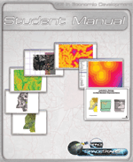
Site selection techniques are used in business, economic development, and many other fields. This book guides you through step by step data, software tools, and strategy to find a site for a warehousing facility, applying geospatial tools and thinking. The three stages featured are: regional indicators, site suitability, and site selection.

GIS in Homeland Security

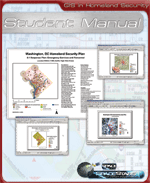
This Homeland Security in GIS course addresses the compilation, management, and analysis of the many different types of critical geographic elements in our communites. It applies to a range of GIS methods to the preparation and implementation of the five phases of Homeland Security strategic planning.

GIS in Law Enforcement

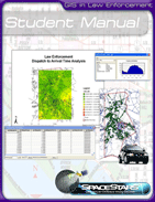
Move into the age of Intelligence Led Policing. Unlock the power of the dormant static police data warehouse!A database is only as good as the question you ask it. GIS is the tool to ask all the hard questions and get answers. Learn how to conduct strategic and tactical analysis to focus your limited resources for effective community policing.

GIS in Mosquito Control

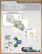
GIS for Mosquito Control demonstrates how geospatial technology is used, specifically, in St. Tammany Parish, LA to manage mosquito populations. St. Tammany’s climate and land cover make it an ideal habitat for mosquitoes and places them at the forefront of managing these populations. Use this book to see St. Tammany uses GIS and how you can apply these practices in your community.

aGIS - a Geospatial Industry Series

Introduction to
Geospatial Technology

What is Geospatial Technology? Where are the jobs in Geospatial Technology? Howmuch does a Geospatial Job Pay? How is Geospatial Technology used in various careers? Why is knowing about Geospatial Technology becoming so important? It is intended for audiences wanting to know more...

aGIS in Agriculture,
Food, & Natural Resources

Students gain hands on experience using ESRI's ArcGIS software in ten lessons that explore: Food Products and Processing Systems, Plant Systems, Animal Systems, Power, Structural & Technical Systems, Natural Resources Systems, Environmental Service Systems, Agribusiness Systems, and Biotechnology.

aGIS in STEM:
Green & Sustainability Focus

Students learn about Geospatial Technology over ten lessons designed to demonstrate key concepts, software capabilities, and future opportunities in the geospatial industry specifically focused on the STEM Career path applied to the growing Evironmental and Green Technologies.